Property Record
1851 Satellite Blvd, Buford, GA 30518
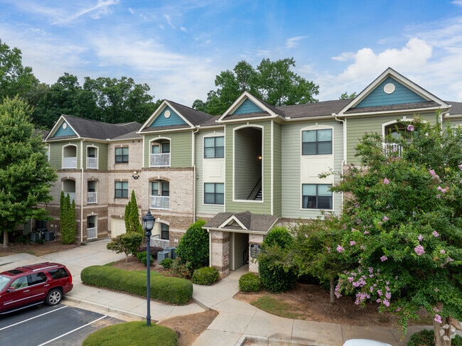

Property Detail
1851 Satellite Blvd
7-216-003
TR 2 SATELLITE BLVD
Apartment
Gwinnett
RM13
Georgia
AE The base floodplain where base flood elevations are provided. AE Zones are now used on new format FIRMs instead of A1-A30 Zones.
29.62 AC
2025
Duluth
2025
Atlanta
050113
Atlanta-Sandy Springs-Roswell, GA
330,562 SF
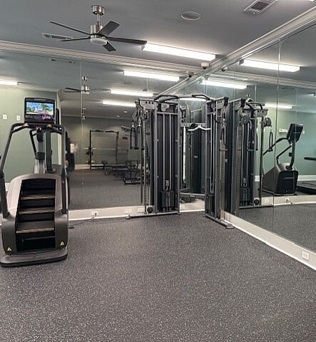
NEARBY LISTINGS FOR SALE OR LEASE
DEMOGRAPHICS near 1851 Satellite Blvd
1 mile
3 mile
5 mile
2025 Total Population
6,278
62,980
167,223
2030 Population
6,559
66,555
176,333
Pop Growth 2025-2030
+ 4.48%
+ 5.68%
+ 5.45%
Average Age
36
37
38
2025 Total Households
2,036
21,509
55,629
HH Growth 2025-2030
+ 4.52%
+ 5.91%
+ 5.65%
Median Household Inc
$91,627
$89,620
$100,341
Avg Household Size
3.00
2.90
3.00
2025 Avg HH Vehicles
2.00
2.00
2.00
Median Home Value
$403,046
$443,658
$439,563
Median Year Built
2004
2002
2000
Nearby Places
Map Layers
Map Styles
 Street
 Aerial
Transit
 Traffic
 Biking
Places
Listings with unknown addresses are not visible on the map
- Restaurants
- Banks
- Shops
- Fitness
- Groceries
Nearby Properties
Address
Land Use
TOTAL SIZE
Lot Size
Zoning
Address
Land Use
TOTAL SIZE
Lot Size
Zoning
1,435,842 SF
83.47 AC
C2
Address
Land Use
TOTAL SIZE
Lot Size
Zoning
629,478 SF
1.54 AC
BG
Address
Land Use
TOTAL SIZE
Lot Size
Zoning
563,718 SF
41.75 AC
RM13
Address
Land Use
TOTAL SIZE
Lot Size
Zoning
419,467 SF
665.75 AC
RZT
Address
Land Use
TOTAL SIZE
Lot Size
Zoning
455,605 SF
33.93 AC
RM13
Address
Land Use
TOTAL SIZE
Lot Size
Zoning
415,963 SF
48.86 AC
RM10
Address
Land Use
TOTAL SIZE
Lot Size
Zoning
461,593 SF
14.11 AC
MUR
Address
Land Use
TOTAL SIZE
Lot Size
Zoning
488,895 SF
7.50 AC
OI
Address
Land Use
TOTAL SIZE
Lot Size
Zoning
394,831 SF
16.37 AC
RM24
Address
Land Use
TOTAL SIZE
Lot Size
Zoning
368,594 SF
2 AC
Address
Land Use
TOTAL SIZE
Lot Size
Zoning
379,178 SF
39.27 AC
RM10
Address
Land Use
TOTAL SIZE
Lot Size
Zoning
384,000 SF
23.08 AC
BG
Address
Land Use
TOTAL SIZE
Lot Size
Zoning
335,641 SF
28.90 AC
RM10
Address
Land Use
TOTAL SIZE
Lot Size
Zoning
431,273 SF
11.68 AC
BG
Address
Land Use
TOTAL SIZE
Lot Size
Zoning
521,231 SF
46.16 AC
HM1
Address
Land Use
TOTAL SIZE
Lot Size
Zoning
282,431 SF
23.20 AC
RM13
Address
Land Use
TOTAL SIZE
Lot Size
Zoning
282,630 SF
11.83 AC
MUO
Address
Land Use
TOTAL SIZE
Lot Size
Zoning
151,663 SF
42.77 AC
BG
Address
Land Use
TOTAL SIZE
Lot Size
Zoning
514,956 SF
47.21 AC
M1
Address
Land Use
TOTAL SIZE
Lot Size
Zoning
313,869 SF
12.19 AC
RM24
Address
Land Use
TOTAL SIZE
Lot Size
Zoning
335,438 SF
10.94 AC
MUR
Address
Land Use
TOTAL SIZE
Lot Size
Zoning
240,556 SF
49.13 AC
HM1
Address
Land Use
TOTAL SIZE
Lot Size
Zoning
461,700 SF
43.77 AC
C2
Address
Land Use
TOTAL SIZE
Lot Size
Zoning
367,756 SF
12.04 AC
RM
Address
Land Use
TOTAL SIZE
Lot Size
Zoning
121,100 SF
3.74 AC
RM24
Address
Land Use
TOTAL SIZE
Lot Size
Zoning
192,805 SF
12.40 AC
RM24
Address
Land Use
TOTAL SIZE
Lot Size
Zoning
323,877 SF
29.14 AC
C2
Address
Land Use
TOTAL SIZE
Lot Size
Zoning
102,152 SF
20.95 AC
C2
Address
Land Use
TOTAL SIZE
Lot Size
Zoning
218,583 SF
2.21 AC
MUO
The World's #1 Commercial Real Estate Marketplace
Connect with us
© 2026 CoStar Group
The information above has been obtained from sources believed reliable. While we do not doubt its accuracy we have not verified it and make no guarantee, warranty or representation about it. It is your responsibility to independently confirm its accuracy and completeness. Any projections, opinions, assumptions, or estimates used are for example only and do not represent the current or future performance of the property. The value of this transaction to you depends on tax and other factors which should be evaluated by your tax, financial, and legal advisors. You and your advisors should conduct a careful, independent investigation of the property to determine to your satisfaction the suitability of the property for your needs.